


Credit: Toshi Maki and Guy Williams
There’s no doubt that drones’ popularity has taken off, and their uses range from simple recreational enjoyment to sophisticated military operations. Over the past year, powerhouse companies like Amazon, Google and Facebook have all announced big plans to integrate different forms of drone technology into their businesses. Meanwhile, recreational drones have proven to be so popular that they’ve already evolved from novelty to nuisance, prompting the U.S. Federal Aviation Administration to require the registration of recreational drones weighing 55 lbs. (25 kilograms) or more.
But in the Arctic and Antarctica, drones face a different roster of challenges, as specially trained and certified scientists test how these autonomous flying machines could help create maps of sea ice in some of the most remote locations on Earth.
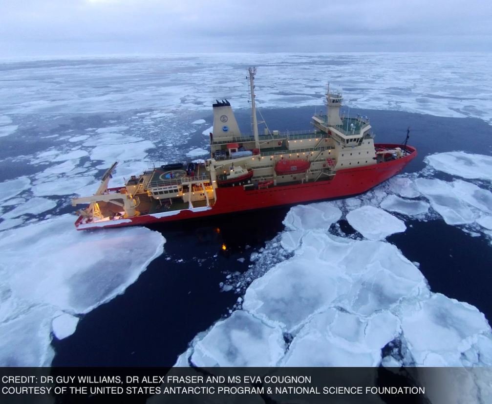
Researchers published a report describing their pilot program on Jan. 19 in Eos, a publication of the American Geophysical Union, outlining an April 2015 expedition to East Antarctica’s ice shelves onboard the U.S. icebreaker Nathaniel B. Palmer, to determine just how well drones would handle the harsh polar environment. [See photos from the drone flights in Antarctica and the Arctic]
Guy Williams, a polar oceanographer at the Institute for Marine and Antarctic Studies at the University of Tasmania in Australia and the designated drone pilot for the expedition, had previously measured sea-ice thickness in Antarctica using an underwater robotic vehicle. He told Live Science that studying sea ice is valuable for scientists monitoring shifts in Earth’s climate, “because what’s going on in the ocean and the atmosphere drive sea ice behavior.”
Atmospheric and ocean changes can affect sea-ice thickness, balance and drift. The effects of a steady warming trend is especially visible in the Arctic, where scientists have observed unprecedented sea-ice loss and slow recovery in recent years.
Credit: Guy Williams/Alex Fraser/Eva Cougnon
But even as Earth warms, the area covered by sea ice is still immense — nearly 5 million square miles (12.3 million square kilometers) was measured in the Arctic in December 2015, according to the National Snow and Ice Data Center, while Antarctica’s sea ice covered more than 7 million square miles (19 million square kilometers) in October 2015 — its maximum for the year.
Because sea ice covers so much area, scientists require satellite imagery to evaluate large-scale changes, Williams told Live Science. “But to develop satellite tools, we need to take observations in the field to test satellite products — that’s where this new age of robotics comes into play,” he added.
Drones could allow scientists in the field to make firsthand observations and measurements of sea-ice coverage, and these robotic fliers are significantly more accessible (and far less expensive) than airplanes or helicopters, which some research groups have previously used to measure Antarctica’s sea ice.
“The Australian program won’t even allow you to fly helicopters over this region,” Williams said. “Drones are the only real option.”
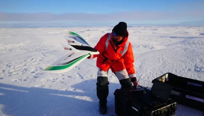
Williams, who was the only certified drone pilot on a three-person team, underwent rigorous pilot training beforehand, accruing 15 months of experience flying drones, and receiving certification from the Civil Aviation Safety Authority in Australia. The National Science Foundation (NSF) required additional reviews before signing off on the expedition, and yet another level of clearance came from the U.S. Antarctic Program, which is still formulating policies and regulations for drone use that protect Antarctica’s environment.
This wasn’t the first time drones had been used in Antarctica, Williams told Live Science, but scientists running earlier field tests built customized machines that required more specialized attention to inn order to maintain and repair them. “We tried to avoid modification,” Williams said. “We try to use what comes off the shelf, so we can readily replace it.”
He selected two off-the-shelf drone models: DJI Ltd.’s Phantom 2 Vision+ quadcopter and the eight-rotor Spreading Wings S1000. The researchers launched them in nine test flights over three days. Once testing in Antarctica began, Williams quickly discovered that winds presented a significant obstacle. Williams described a maximum wind speed of about 12 mph (19 km/h) as ideal for drone flights, but the winds in Antarctica rarely dropped below 23 mph (37 km/h), he said.
“We were constantly waiting for the wind [speeds] to drop,” Williams said. “We had to be ready to go when the wind dropped and take advantage of that.” [Incredible Drone Photos: Contest-Winning Images from Above]
As if the conditions weren’t challenging enough, Williams found he couldn’t fly the drones in GPS “autopilot” mode, which allows stable, autonomous flight. Williams said he suspected the strong magnetic pull of the South Pole was to blame. Without GPS mode, Williams could still pilot the drone, but he needed to use manual controls almost exclusively, “and that’s where the skill level of the pilot requirement increased,” Williams said.
Credits: livescience


